


Weather information for the Breckenridge area is provided below. Average temperatures, climate details and current forecasts are included!
Climate
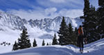
At over 9500 feet in elevation, the town of Breckenridge has a moderate climate. Though the weather is sunny most days of the week, each season the town receives nearly 300 inches of snowfall. Winter temperatures usually stay below freezing.
In summer, daytime temperatures reach into the low 70s. The high altitude and rapidly changing weather mean visitors at any time of year should be prepared for changing conditions.
Live weather is currently unavailable.
Please visit weather.gov for current and forecasted weather.
Today
Chance Snow Showers then Chance Showers And Thunderstorms
Tonight
Slight Chance T-storms
Saturday
Light Snow Likely then Showers And Thunderstorms
Saturday Night
Slight Chance Snow Showers then Partly Cloudy
Sunday
Sunny then Slight Chance Rain Showers
Sunday Night
Mostly Clear
Detailed Forecast |
|
|---|---|
| Today | A chance of snow showers before 10am, then a slight chance of rain showers between 10am and noon, then a chance of showers and thunderstorms. Partly sunny. High near 52, with temperatures falling to around 49 in the afternoon. West wind 9 to 18 mph, with gusts as high as 30 mph. Chance of precipitation is 50%. New rainfall amounts less than a tenth of an inch possible. |
| Tonight | Rain likely and a slight chance of thunderstorms before 8pm, then a slight chance of thunderstorms and rain and snow likely. Mostly cloudy. Low around 30, with temperatures rising to around 32 overnight. South southwest wind 9 to 13 mph, with gusts as high as 21 mph. Chance of precipitation is 70%. New snow accumulation of around one inch possible. |
| Saturday | Snow likely before 11am, then a chance of rain between 11am and noon, then showers and thunderstorms. Mostly cloudy. High near 51, with temperatures falling to around 48 in the afternoon. West southwest wind 6 to 14 mph, with gusts as high as 22 mph. Chance of precipitation is 80%. New snow accumulation of less than half an inch possible. |
| Saturday Night | A slight chance of snow showers and a slight chance of thunderstorms before 9pm. Partly cloudy, with a low around 26. West wind 6 to 12 mph, with gusts as high as 17 mph. |
| Sunday | A slight chance of rain showers after noon. Sunny, with a high near 57. West northwest wind 7 to 16 mph, with gusts as high as 24 mph. Chance of precipitation is 20%. |
| Sunday Night | Mostly clear, with a low around 33. |
| Monday | A slight chance of snow showers before 9am, then a chance of rain and snow showers. Mostly sunny, with a high near 59. Chance of precipitation is 30%. |
| Monday Night | Partly cloudy, with a low around 31. |
| Tuesday | A chance of showers and thunderstorms after noon. Mostly sunny, with a high near 59. |
| Tuesday Night | A slight chance of showers and thunderstorms before 10pm, then a slight chance of thunderstorms and a slight chance of rain and snow showers between 10pm and midnight. Mostly cloudy, with a low around 32. |
| Wednesday | A chance of showers and thunderstorms after noon. Mostly sunny, with a high near 62. |
| Wednesday Night | Mostly clear, with a low around 32. |
| Thursday | A slight chance of snow showers before 11am, then a chance of rain showers. Mostly sunny, with a high near 59. |
| Thursday Night | A chance of rain showers before 8pm, then a chance of snow showers. Mostly cloudy, with a low around 30. |